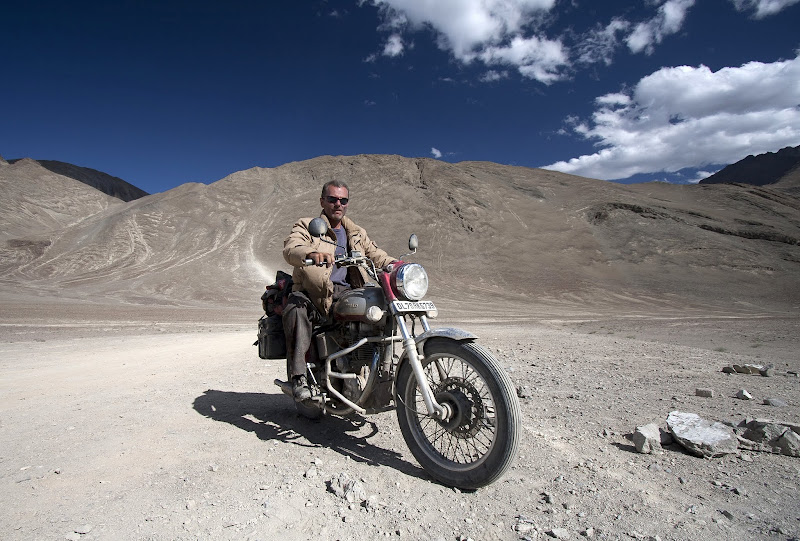
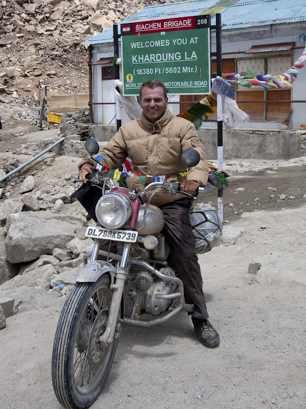
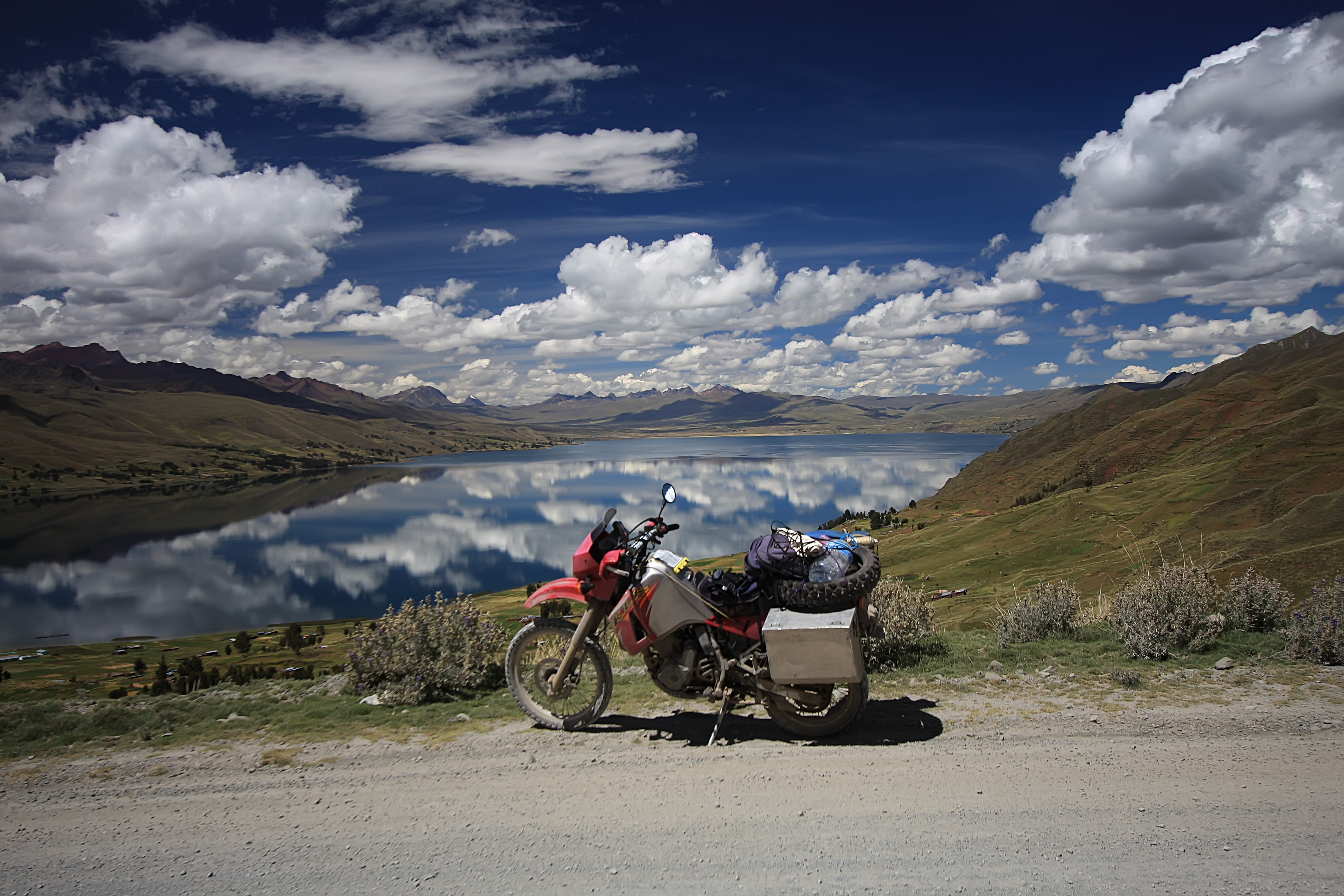
The route traveled over a 10 month period
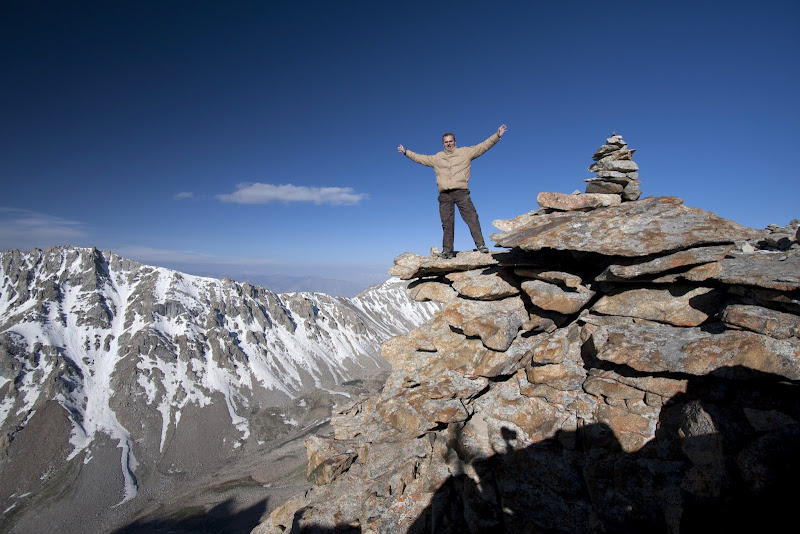
The plan was to ride from LA south as far as the bike will take me with a list of places that I’d like to see. As it turned out, the bike took me 35,000 miles and it could have gone more had it not been for the traveler’s fatigue.

On the way to Gonzaga Bay
I had been reading books and other people’s travel reports to get some feelings for what to expect on the road. Apart from a few people who had some accidents and minor mishaps, everybody seemed to have a blast. Still, media-brainwashing did make me correlate anything south of Tijuana with crime, corruption, killings, kidnappings, violence, bad roads, bad drivers, etc. The only way to find out the truth was by checking things out myself.
So the trip started in LA on a beautiful clear day under Santa Ana conditions. I battled the winds on the way out of LA basin. That first day, I only crossed into Mexico and went far enough from the border to feel comfortable. My headlight bulb died promptly after crossing the border. I noticed it only after near-head-on collision with a car trying to pass another vehicle. The sun was setting behind me and the driver didn’t see me because my headlight was not working. Getting killed a few hours after crossing the border would have been embarrassing!

Bizzare trees of Baja California
After a quiet night in San Felipe, I took a dirt road along the Sea or Cortez, passing some pristine, deserted beaches. I wish I had more time to explore and enjoy the many scenic spots. But I knew that there were thousands of miles ahead of me and I had to keep on moving. It took me about a week to ride through the sparsely populated Baja California. Winter refugees from the US and Canada comprised a big part of the population there.

One of many beaches with snowbirds

Bahia Concepcion, Sea of Cortez

Cabo – the end of the road along Baja
From La Paz, I took an overnight ferry to the mainland. I didn’t spend much time in the touristy Mazatlan. Instead I headed for the mountains along the famous road – Espinazo del Diablo. After a cold night in Durango, I continued along the spine of Mexico’s Sierra Madre mountains. The road took me through many historical towns, Zacatecas, San Luis Potosi, Dolores Hidalgo and San Miguel De Allende, along the independence trail. Eventually I got tired of being cold and headed east towards the Gulf coast.

Espinazo del Diablo

Zacatecas delivery

Fine colonial architecture of San Louis Potosi


Guanajuato’s colorful houses

Guanajuato street art

Guanajuato at night

San Miguel de Allende

San Miguel de Allende
I had big expectations from Veracruz in terms of its colonial history. I was a bit disappointed not to see any traces of its former glory. Still, it was warm and comfortable. After two nights, I headed for the hills again. I passed by Pico de Orizaba, the highest peak in Mexico and ended up in Oaxaca – a nice city with great Aztec ruins just a few miles away.

Gargoyle with cactus growing out of it

Oaxaca main square

Ruins outside Oaxaca
From there, it was across another set of heavily forested mountains to the Pacific coast. Now I was hot, but I liked it. Half a day ride took me to the official entry point into Central America – Isthmus of Tehuantepec. I arrived into San Cristobal de las Casas, probably the nicest town I’ve visited in Mexico. It sits pretty high up in the mountains and the climate is eternally spring-like. I made a quick two-day trip to Mayan ruins of Palenque. I loved the ride through lush rain-forests of the Yucatan peninsula.

One of the pedestrian-only streets in San Cristobal de las Casas

Main square in San Cristobal

A park on the way to Pelenque

Sam Crostobal by night

KLR riders heading in different directions
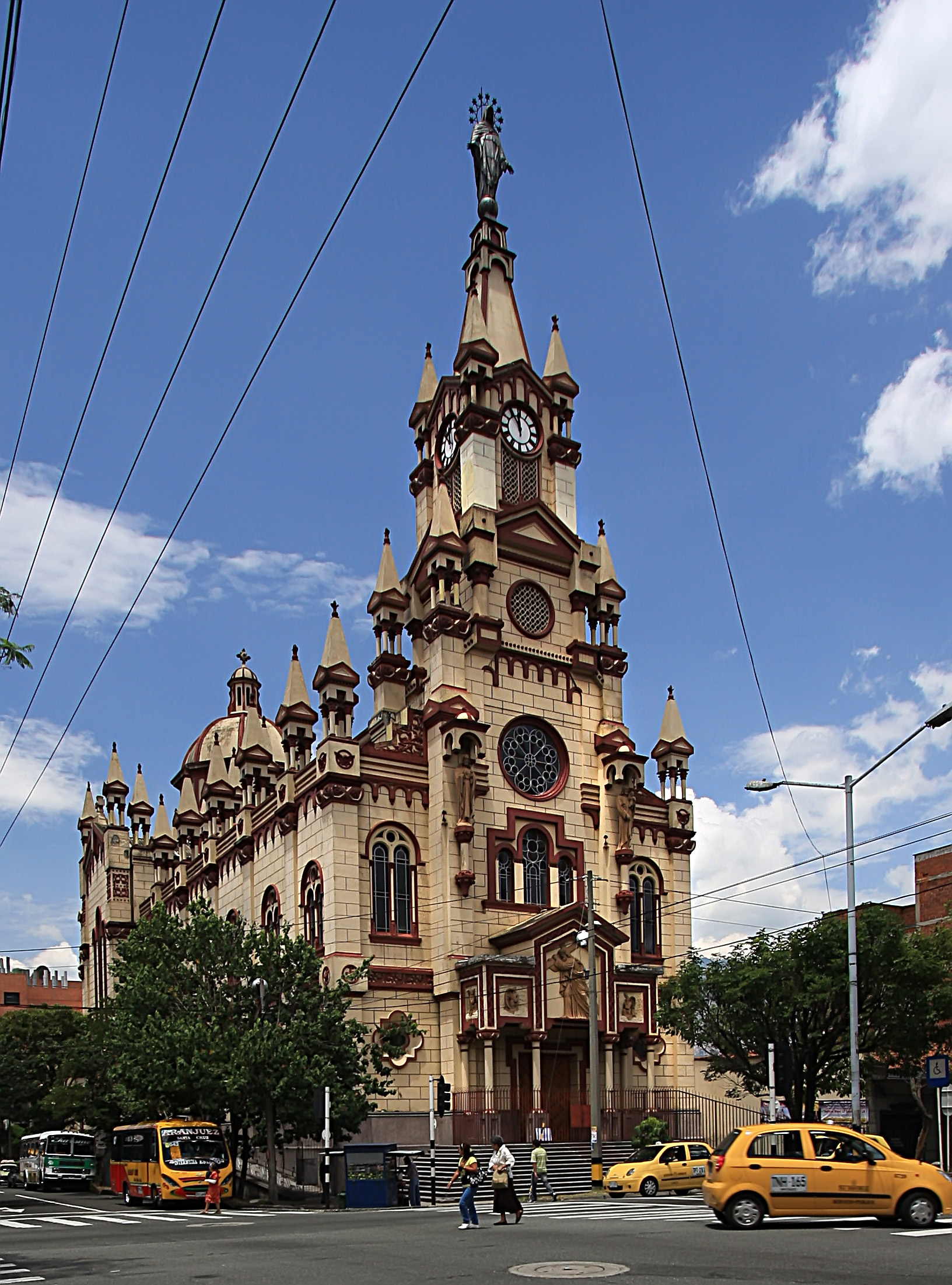
By this time, I had spent almost a month going through Mexico and I loved it, but it was time for a new country, new food, new customs, new driving habits. Entry into Guatemala was painless. After about an hour at the border, a pleasant mountainous road took me to Quetzaltenango or Xela for short. I decided to learn some Spanish there. Many tourists do that as it is very cheap. The town was a bit on the cold and boring side for me. So I was happy to head to Antigua next week. After five more days of learning Spanish there and enjoying the historic town, I rode to lake Atitlan. The lake is surrounded by a number of volcanoes which make it one of the most scenic lakes I’ve seen. I stayed in backpacker’s town of Pana in a comfortable posada. The weather wasn’t exactly cooperating. It was mostly cloudy and eventually it started raining. I spent rainy days in Chichicastenango watching local festival with dancing, fireworks and lot of drunk people.

Antigua

Festival in Festival in Guatemala, Guatemala

With party in full swing, all men are drunk

Local market in Chichicastenango
From there, I took some back-roads to visit Tikal, the granddaddy of Mayan ruins. In all honesty, I liked Palenque more. It might had something to do with a major stomach infection I got at Lake Peten Itza. On the bright side, it was hot and the riding was pleasant enough.

Girl selling dolls

Jungle ride

Enjoying warm waters

Cute cocoa seller

Tikal
I was itchy to see the Caribbean coast again. So I left my bike in Rio Dulce and took a boat to the coast. The boat ride along the wide river was definitely the best part of this detour. The whole area was covered with thick rain-forest. Rio Dulce is a big hub for boaters from all over the world. Maybe one day I come back to Rio Dulce with a boat instead of bike.

Rio Dulce
By this point, I had enough of Guatemala and I was ready for El Salvador. The most striking feature of El Salvador is the number of volcanoes. They are everywhere. The first night there, I spent camping near the top of one of the volcanoes. They even had volcano boarding (like snowboarding, but on volcanic ashes). A pleasant ride along the Pacific coast took me to a lovely Salvadorean-Dutch-run posada outside La Libertad. Local KLR rider Mario helped me get a new front tire in San Salvador, took me to a New Year’s party and rode with Alisa and I around the country. He showed me one of the nicest and most comfortable posadas in Suchitoto. Thanks Mario!

Crater lake in El Salvador

At San Salvador volcano with Mario and Alicia

The hotel restaurant in Suchitoto
I paired up with Kent, a Canadian rider, for the infamous border crossing into Honduras. It wasn’t nearly as bad as we had expected. A few hours later, we were in Nicaragua, in town of San Leon. We weren’t particularly impressed with it and moved on to Granada, which was much more pleasant. We tried to visit remote Corn island, but we arrived into Bluefield right after a boat departed. Weather didn’t look too inviting for a sea journey anyways. So, with tails between our legs, we went back to the mainland and rode to the Pacific coast visiting Lake Nicaragua and Island Ometepe in it along the way.

Granada, Nicaragua

Granada

Deserted beach in Nicaragua
Costa Rica was too expensive and too non-Latin for my taste. MacDonald’s, Burger Kings and other fast-food joints clearly indicated that it was land of too many gringos. I spent a few days exploring coastal towns. I had some mechanical problems along the way, but the friendly bunch on ADVrider helped me resolve them. After that I headed into the mountains to visit famous cloud forests. Again, I was disappointed to fall into another tourist trap. On the way back, I missed a turn off for the coast and ended up in the capital – San Jose, at night. I was not amused by the idea of looking for decent accommodation in an unknown city at night. Luckily for me, a friendly rider on a beautiful KTM stopped at a light next to me and offered assistance. He took me to a clean, quiet and centrally-located hostel with secure parking – Thanks Misha. After San Jose, I went deeper inland, visiting some volcanoes and crossing beautiful mountains. I wanted to visit Atlantic coast again, but the weather looked nasty. So I headed back to the dry Pacific coast. One more day or riding along the undeveloped eastern coast of Costa Rica took me to Panama.

Costa Rica’s highlands

About to board a ferry to mainland Costa Rica with a fellow rider
Panama was the last country of Central America. Border crossing was rather painless. After a good night rest in David, I decided to go to Bocas del Toro – an archipelago off the Caribbean coast. I had to park bike overnight and take a boat to the islands. It was clearly a party town with scores of surfing youngsters from all over the world. Back to the mainland, I finally made it to the Panama Canal and Panama City. I was excited to go to Colon, mostly because of its bad reputation for crime. The whole area around Colon was full of historical markers – fortresses and famous landing spots of Colombo and other explorers. I met Alisa (whom I had met previously in El Salvador) and we rode together to the end of the road in Panama – Darian Gap.

The last border crossing in Central America
I tried to find a boat that would take me and my bike to Colombia. But all the effort was in vain. None of the captains were going all the way to Cartagena. They were willing only to take me and the bike across the border with Colombia with no road connections to continue. Form there, I’d have to get another boat to get to a place with road connections. Finally, another KLR rider found a boat whose captain was willing to take us to Cartagena (the only such boat). It sounded too good to be true, but we went for it anyways. Should have known better! While the San Blas islands were breathtakingly beautiful, our journey didn’t go very smoothly. We ended up on a broken ship, dumped in a place without roads just across the border with Colombia, the exact thing I was trying to avoid all along. A few hundred dollars and a scary ride on a super fast motorboat later, we arrived into Turbo. It felt so good to be on the mainland with road connections again. I headed straight to Cartagena, one of the big items on my list of places to visit.

Riding through Panama’s jungles to Bocca del Toro

From this pass, once can see both Atlantic and Pacific oceans
The infamous Colon

A lot of old forts dot Panama – Portobelo

Sunset in Panama City

Yaviza – the end of the road going south

Welcome to Darian Gap

Sailing San Blas islands
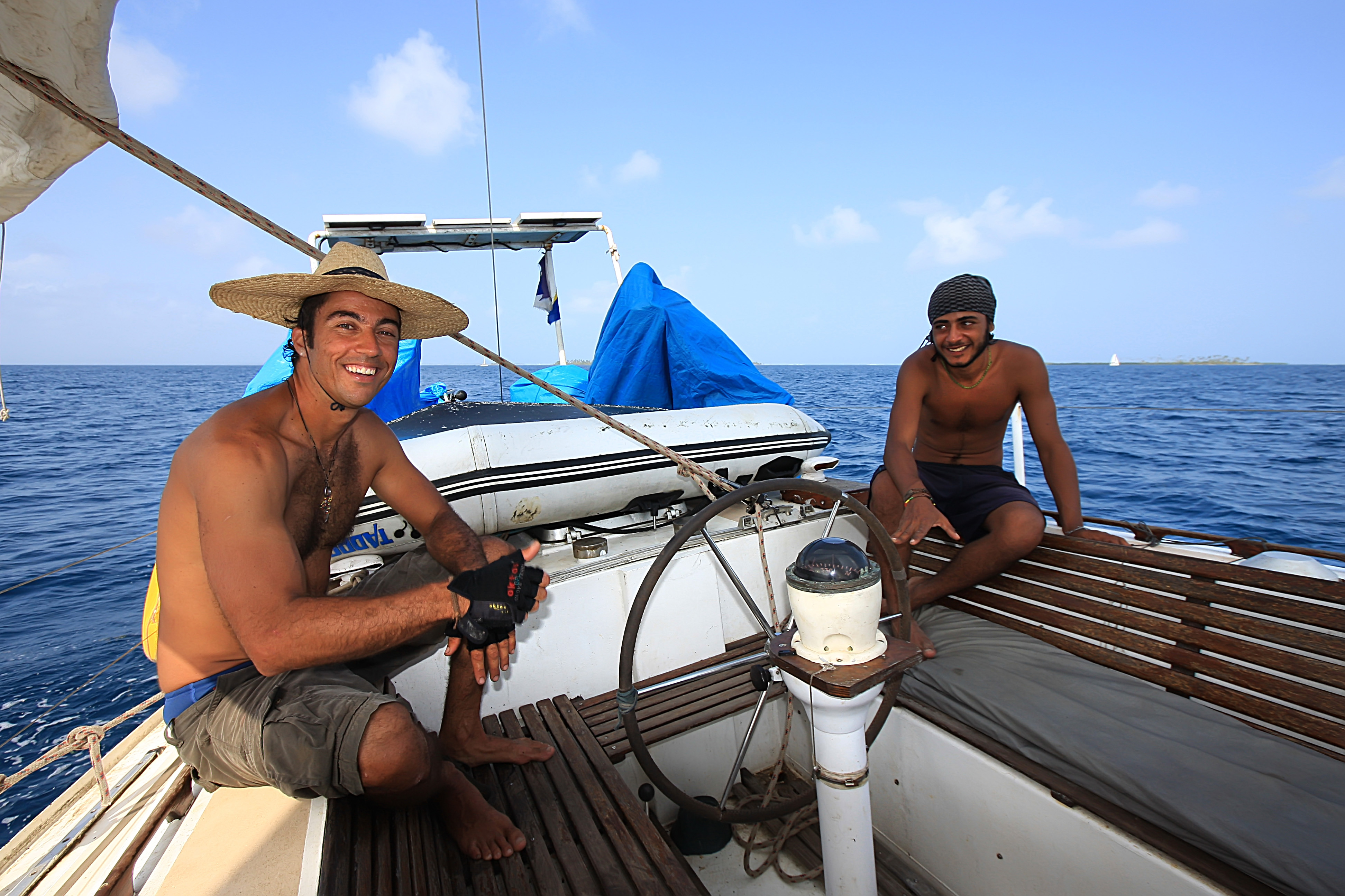
Our crew

One of many uninhabited islands

moored for the night
Cartagena was everything I had hoped for and then some more. Buildings, streets, little squares, gardens and fortresses were beautifully restored and maintained. The place reeked of history. Another great thing about Colombia are fruit juices. Passion fruit and lulo were my favorite. There were fruit joints at every corner. One is never thirsty in Colombia.

First taste of Colombia – Capurghana pier

A sloth roaming around Cartagena

Cartagena city walls

Cartagena fortress

Quiet street in Cartagena


One of the squares in Cartagena

Another square


Cartagena

The many balconies of Cartagena

I was sad to leave Cartagena, but there were many other places awaiting to be explored. I headed east towards Barranquilla. I wanted to be there for the big carnival. But I couldn’t wait a whole week. So I headed further east to a seaside town of Santa Marta and backpackers enclave of Taganga. While having a lunch, I ran into Micha, a German rider whom I had met in Panama city almost a month before. He was riding around with his Canadian buddy. I joined them for a few day trip to northernmost point of Colombia and South American continent. I never knew that Colombia had such a big desert. Miles and miles of roads with no people, villages or cars. Needless to say, all the beaches were nearly empty.

Taganaga

Riding norther deserts of Colombia

Had my chain snap in the middle of nowhere

Inhospitable coast of northern Colombia
After 3 days of riding in this great company, it was time to break off and go on my own again. I headed into Venezuela. As luck would have it, I entered Venezuela on the first day of the Carnival weekend, with an empty gas tank, no local currency and no temporary importation permit for the bike (Customs office was closed). Had I done my homework, I would have known that the bolivar (Venezuelan currency) is not freely traded and that the official exchange rate for the USD is about half of what the black market rate is. So none of the ATM were accepting my card. Things didn’t look pretty. I got ripped off getting gas from a can at the back of some guy’s house. Then in the evening, a “kind” cop offered to exchange some USD for the local currency at the official rate. Still, I was glad that I could at least buy food and pay for accommodation now. Unfortunately, I passed most towns with hotels before I got the money. As the night approached, with no hotels in sight, I desperately asked a local family in one village if I could pitch a tent in their back yard. They were more than welcoming. They made sure I was well-fed, I was safe and that my bike was securely parked. That was a great end of not so great first day in Venezuela. I spent next day thinking about kindness and greed, how kind and helpful people can be, no matter how little money they have. I was actually very happy that I had that great experience the first day in Venezuela

BBQ-ed bananas, one of my favorites

The family that took me in on my first day in Venezuela

Road-side art in Baranquilla
Somehow cops at checkpoints along the way bought my story how customs office was closed and that I was going to get the permit in Caracas. None of them made big deal out of it. I had to admit that I was slightly worried about how a western tourist would be treated in Venezuela, especially by the police and military. As it turned out, everybody in Venezuela was friendly and welcoming.
I spent the Carnival weekend in Caracas in an area infamous for crime. Everybody told me not to go out at night and to be super careful even during daytime. I took their advice, but they were probably exaggerating. Caracas is a big city, with modern subway, some nice parts but very little in terms of historic old town. I visited Bolivar’s birth house, rode a cable car to the top of the range that separates Caracas from the coast. It was a breathtaking sight to look down almost 10,000 ft to the ocean and 3000 down to the city on the other side.
After the long weekend was over and the main customs office opened, I went to get my permit. To my great disappointment, I was told that the only place that could issue the permit was the office where I entered the country – 1000 km backtracking. As the seriousness of my situation started to sink in, a kind lady named Elena passed by and asked if I needed help as her English was much better than my Spanish. I explained her my problem and she promptly took upon herself to take care of it. Thanks to Elena and cooperating staff there, a copy of my passport was faxed to the border post where I entered Venezuela. They entered data into the computer system, stamped the copy and faxed permit back to the main office. The main office endorsed faxed copies with a few more stamps to confirm that everything was legit and I was on my marry way out of Caracas by mid-afternoon. It’s amazing how kind and helpful people can be. Such a desperate situation turned out to be a non-issue thanks to Elena of Aduana office in Caracas – thank you so much Elena.

Caracas

national park high above Caracas
After Caracas, I headed to the Isla Margharita. I’ve heard so much about it and had to visit it. Once on the island, I made a quick tour of it and slept on the beach. It was a nice island, but it lacked white sand. My idea of a tropical beach requires white sand. So I jammed back to the mainland the next day and ended up in a beautifully restored colonial house turned into posada in Ciudad Bolivar. Gran Sabana was another big item on the list of things to see in South America. I wanted to go to the top of Angel Falls, but there was no road to ride there. I would have had to fly in and then hike for several days. So I spent 3 days riding in Gran Sabana instead. The scenery and climate there were breathtaking. I enjoyed every second of my stay there. There were many swimming holes, several famous tepuis (table-mountains) and some nice waterfalls along the way to Brazilian border. I camped for two nights at the plateau before heading back to Ciudad Bolivar.

Gran Sabana

Cool swim

Atop a waterfall with Roraima in the distance

Gran Sabana camping

Ciudad Bolivar

On the way to Merida, Venezuela

Atop waterfall in Gran Sabana

Angel’s plane (Angel Falls were named after this adventurer)
Going down into Brazil would have been a great idea, but I wanted to see the mountain town of Merida, home of the world’s highest cable car. It took me two days to get there. Unfortunately, the cable car was under repair and I didn’t get to ride it. The city itself was lively, with big student population. It is also a hub for outdoor sports.
Things were not cheap in Venezuela, especially if one changed money at the official rate. Only gasoline was ridiculously cheap – about 9 cents a gallon. On few occasions gas station attendant didn’t even want to take the money I owed for the gas I bought. Overall, Venezuela was a pleasant surprise, especially from the officials I dealt with – from roadside checkpoint cops to Elena and her coworkers in Caracas. I could recommend going there to anyone, just make sure you bring enough hard cash in your pocket and find a good place to exchange the money on the black market. I am looking forward to visiting Venezuela again.
Back in Colombia, I headed up into mountains again. I loved riding through Colombia. So many scenic roads going across high passes, through deep valleys and lush rain-forests. I was hosted in Bogota by Javier, a fellow rider, who helped me get some spare parts for the bike. I enjoyed my stay in Bogota, its pleasant weather, good food, great juices, scenic mountains above the city and friendly residents. Next, I headed to Medellin, another modern, beautiful Colombian City. It sits high up, just like Bogota and has a very mild weather. Once again, I ran into my Micha and his buddy. They were spending an extended time in Medellin. Despite Medellin being so nice and comfortable, I was too restless to spend more than a few days there. After visiting coffee plantations of Manizales and idyllic Cocora Valley, I went to Cali and Popayan on the way to Ecuador. Colombia was another great surprise of my trip. Former kidnapping capital of the world was transformed into a safe and booming place. Colombia is another place I could recommend anyone without any reservations.


A church in Barichara

Old colonial village

San Gil

Tunja

Mountain ridge above Bogota

With Javier, my host in Bogota

Colonial buildings in Bogota

Medellin
A church in Medellin

Manizales

Coffee plantations around Manizales

Cali

Popayan

Famous church in Ipiales
Ecuador was a much lower key place than Colombia. People seemed quite content with whatever they had or didn’t have. Nevertheless, the scenery continued to be spectacular. I rode mostly along the spine of the Andes, passing near high volcanoes. After spending a night in Otavalo with famous market and hunting for exact spot of crossing the Equator, I rode into Quito. Most highly recommended accommodation in Lonely Planet guidebook – Swiss Something, turned out to be a smelly, overpriced dump. So I found a great, quiet hotel on one of the main squares with indoor motorcycle parking for less than a dorm room in Swiss Something. Lonely Planet is a great guidebook, but some places that get recommended by it become overpriced backpackers’ ghettos. After a few days of Exploring Quito, I headed out to Quilotoa loop with the famous crater lake. I stayed in a very quaint village overnight, probably one of the top ten memorable accommodations of the trip. Unfortunately, it was too quiet and a bit cold. Next day, I headed to Banos on the Amazon side of the Andes. It got warmer, but also wetter.

Quito’s main plaza

Quaint village

Crater lake

A happy monkey

Amazon side of Ecuador
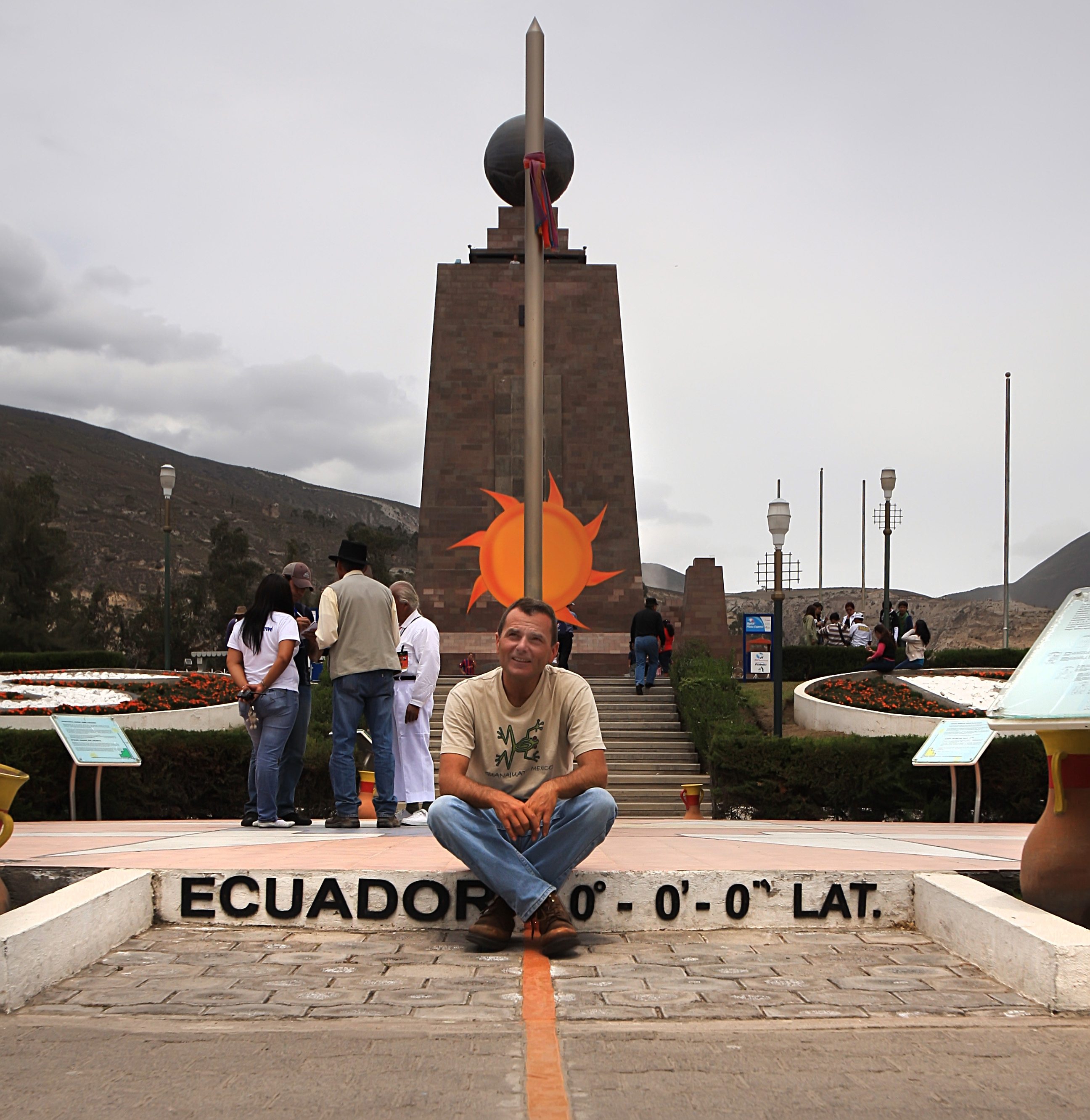
When in Ecuador, must sit on Equator

Bars and hostels in Mariscal area of Quito


Colonial architecture everywhere

Old town
Riding further down into the Amazon basin, I got to another backpacker’s town – Tena. What I liked about this area the most was the tropical feel of being in the Amazon. Riding was superb on newly paved roads with virtually no traffic. The following day I finished this big loop by ending up in Quito once again. While riding around looking for a place to stay, I ran into my old Canadian friend who showed me the place where he was staying. It was also centrally located and it had parking – what more could a rider ask for? We enjoyed the last night in Quito together and I left the city for the last time heading west, to the coast.
It was rather interesting how the Pacific coast looked so much like the coast in California (maybe a bit warmer as it was right on the Equator). It was here that I had the most pleasant stay of the whole trip in some no-name village right on the beach. There were no facilities in the village, but my veranda was overlooking the ocean and I loved going to sleep while listening to the loud surf.

Ecuador’s coast

Sunset in Bahi de Caraquez

The most idyllic gueshouse I’ve stayed at

White sand beaches of Salinas
Further south, I came to the nicest beach I’ve seen along the Pacific coast – Salinas. It was clearly a touristy town and I enjoyed a lunch while looking at the white sand beach and green-blue ocean. I had a hard time finding accommodation. So after a few hours of looking around, I headed back inland towards Guayaquil. This is the second largest city in Ecuador. It had an interesting old town and nice boardwalk, but otherwise, not much to keep me there for more than a day. Next destination was Riobamba with its famous Devil’s nose train ride, which unfortunately did not run at that time. So I continued to Cuenca, where Dave, a fellow rider, lived and had lunch with me. I really wanted to explore the road that goes into Amazon basin more, but I’d heard that it was not in a great condition and I had experienced more rain in Ecuador than I cared for, so I headed south to Peru.


Cuenca market

Cuenca

Lunch with friends in Cuenca

Loja


Don Quixote is everywhere in South America

I entered Peru at a small border post without any exchange facilities. I was fine with being hungry till next town where I could withdraw money, but I was concerned with running out of fuel and being stuck without money to buy it. Luckily, I made it to a town with a number of banks and I finally found one where I could withdraw money. Upon entry into a new country, it is always a challenge to figure out which local banks allow foreign-issued ATM cards to withdraw money.
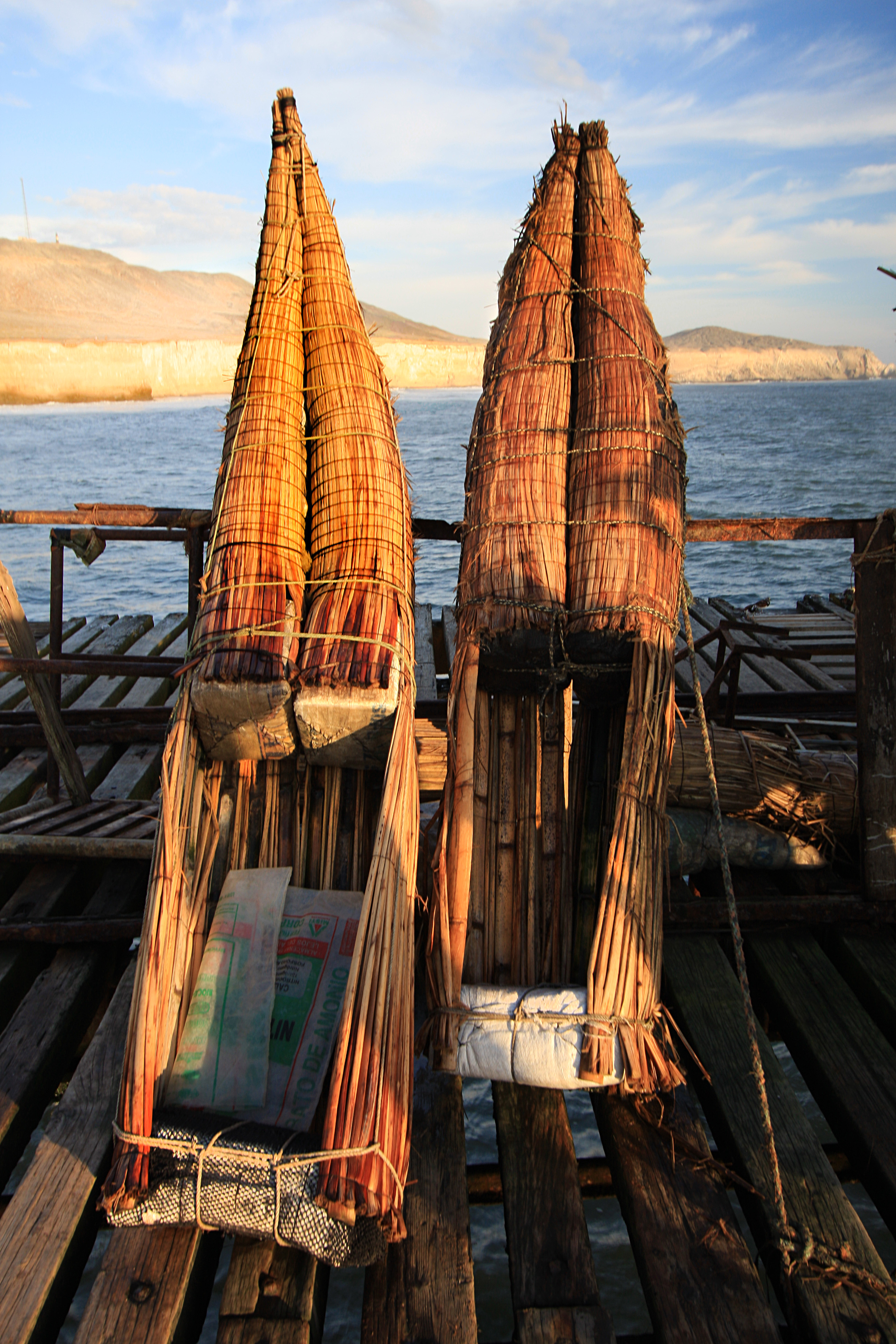
Traditional Inca surfboards

Fisherman

Another beautiful sunset over the Pacific

Trujilo

Over the mountains into Huaraz
Peru is a big country with varied terrain and climate. For me, the highlight was going to be visiting Cordillera Blanca – probably the most beautiful section of the Andes. So after a few days of enjoying coastal towns and some ruins, I headed to Huaraz – gateway to the Cordillera Blanca. Unfortunately, I was there during rainy season and most of the time beautiful glaciated peaks were obscured by clouds. I still got lucky on a few occasions and manged to ride up to high lakes and passes. I spent one night in a quiet town of Caraz on the way to Canon del Pato. This town too had a great location and climate. After the wonderful time in the mountains, it was time to go back to the coast and Lima.

Easter celebration in Huaraz

Huascaran – Peru’s highest peak partially obscured by clouds

Canyon del Pato
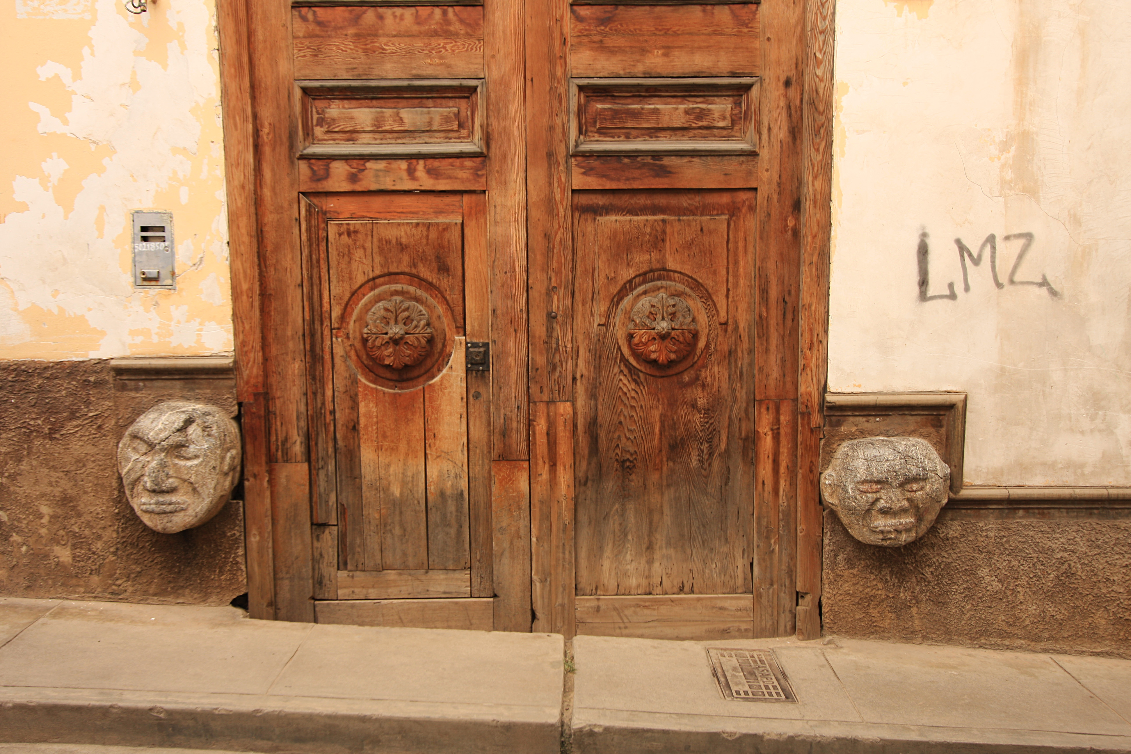
Old door in Caraz

Cordillera Blanca


One of the high peaks surrounding lake Paron

Peak taht inspired Paramount motion picture’s logo


Lago Llanganuco


Llanganuco from a pass high above
I was little concerned about the cops around Lima. I had heard bad stories about them and how unscrupulous they were. But I was lucky enough to be treated nicely by them every time they stopped me. In Lima, I stayed in a hostel in Miraflores – the fancy part of the city. It was a great spot except for the bed bugs. I changed beds three times and there were bed bugs in all of them. So disgusted and worn out by the lack of sleep, I jammed out of Lima with Micha (who caught up with me).
We decided to swing by Paracas national reserve on the Pacific coast. Our planned 1-2 hour visit turned into a great overnight stay at the edge of sand dunes overlooking Pacific ocean. It was another great wild camping experience. The next morning, we parted ways for the fourth time as he was in a hurry to get to Patagonia before weather turned too cold. I headed further south along the coast to Nazca – the site of famous Nazca lines. I had some stomach problems there, so I didn’t see the lines even from the observation deck. From there, I rode coastal road south to Arequipa – the white city. I had heard a lot about it, but it didn’t leave a particularly good impression on me. From there, I went to the deepest canyon in the world – Colca Canyon.

Lima

Paracas

Off-roading in Paracas

Taking it easy in Paracas


Late afternoon in Paracas

Wild camping at its best in Paracas


Ica oasis

Pan-Americana along Pacific coast
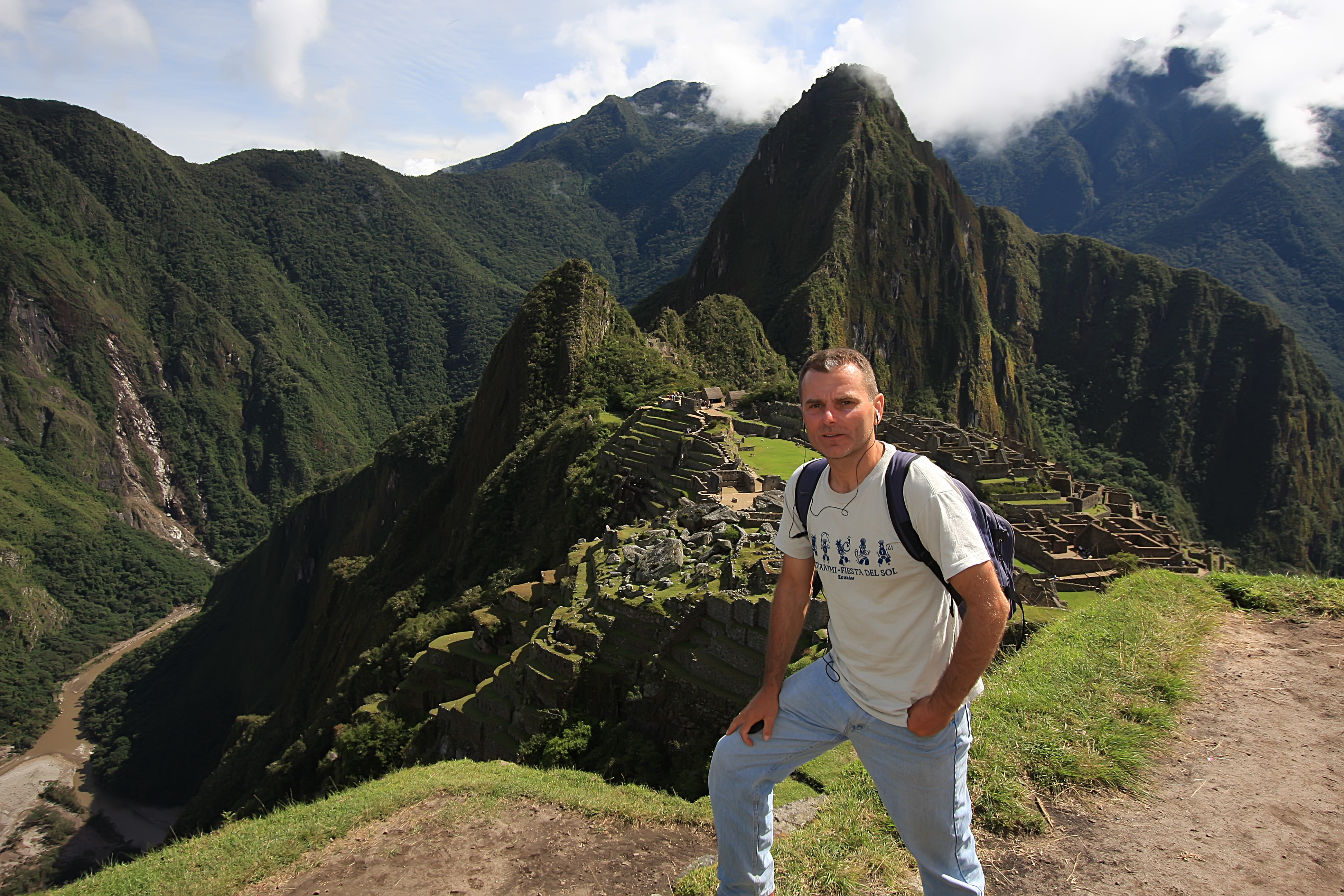
After another long day of dirt riding through beautiful but very remote areas, I made it to Cuzco. Cuzco is a wonderfully restored city combining colonial and pre-colombian architecture. It has a number of comfortable hotels and restaurants. It is most famous as the jump-off point to visit Machu Picchu ruins. I stayed in a hotel that Alisa recommended to me. Once again, I met Micha who just couldn’t make it to Patagonia. It was already getting late in the season and he was way behind his schedule. After a few days of exploring Cuzco, I was on my way to Machu Picchu. The road from Cuzco towards Machu Picchu is very scenic in itself. It goes over a high pass and eventually drops into the Amazon basin. A dirt track goes only as far as a village 10-15 km from the town of Aguascalientes. From there, it was about half a day hike through a beautiful tropical canyon several thousand feet below ruins of Machu Picchu. This hike was the highlight of my visit. Aguascalientes is an idyllic town in itself. It is situated at the confluence of two mountain rivers descending steep gorges. For some reason, the scenery there reminded me of Switzerland. It was a beautiful little village albeit too touristy. Next day, I went to visit the ruins. I spent a whole day hiking around, taking pictures and just soaking the atmosphere. Another enjoyable hike back and half-a-day ride took me back to Cuzco.
Over the Altiplano to Cuzco

Cuzco’s main cathedral

A Cuzco girl with her llama

Famous Inca wall

Cuzco’s colonial architecture

Cuzco ladies posing for picstures

Creek crossing on the way to Machu Picchu

After clouds lifted off

Inside a courtyard in Cuzco

Ran into this fellow rider four times in four different countries

Cuzco’s alley

San Blas area

Another girl trying to make living with her llama

Heading to Bolivia

Floating village on lake Titicaca


Cruising lake Titicaca
By this time, I had spent almost a month in Peru. Bolivia was calling me. So after a short visit to Puno and nearby floating village on lake Titicaca, I entered Bolivia. I spent first two nights in Copacabana – a touristy village on lake Titicaca. I took a half-day tour of the lake and visited Isla del Sol. There was a storm approaching Bolivian Cordillera Real and I was hoping to visit those beautiful mountains after the storm. But I couldn’t wait, so I headed straight to the capital – La Paz. In stark contrast to the rest of Bolivia, La Paz is a modern city with some colonial parts. It is dominated by Illimani – a towering 21,122 ft peak east of the city. Aftert a couple of days exploring La Paz, I rode the “death road” with another rider. There is nothing terrifying about this road any more since most of the traffic goes on the new, paved, bypass road. The road took us to Coroico village with sub-tropical climate. After a lunch there, we rode back to La Paz on the paved road. Since we were not too keen on riding through La Paz again and looking for a hotel, we went straight north towards Lake Titicaca again. We spent a night in an expensive, but comfortable hotel on the lake shore.

Puno lady


A Bolivian lady

Bolivian lady at a market
Next day I went into Cordillera Real mountains. The weather cleared up and I could see many glacier-covered peaks. I rode up to over 5000 M to a pass. Despite having spent more than two weeks at elevations of over 4000 m, I felt nauseated and descended down to about 4200 to camp. Before it got dark, a guy came to check out my tent. He was watching his sheep and sleeping in a shack not far away. He made me worried when he giggled after I told him that I was going to sleep there in a tent and had only two blankets. Well, it was too late at that point to go and look for a warm hotel. The night was pretty chilly, certainly below freezing (water in my bottle froze solid) and I didn’t get much sleep worrying about just how cold it was going to get. Finally the sun shone on nearby peaks and soon things started defrosting. I went up and down the hill a few times to warm up. It was another beautiful day, so I headed to the high pass one more time, to enjoy clear morning air. I really enjoyed this part of the Andes and decided to go to another section almost to the glacier boundary. After making several action shots on the bike, I headed to lower elevations. This area was most definitely one of the highlights of the whole trip. I enjoyed high mountains so much that I ended up getting to Sorata, a backpacker’s enclave on the eastern slopes of the Andes, well after dark. Luckily, climate is much warmer in Sorata and good accommodation was plentiful.

Getting motorcycle blessed in Copacabana, Bolivia

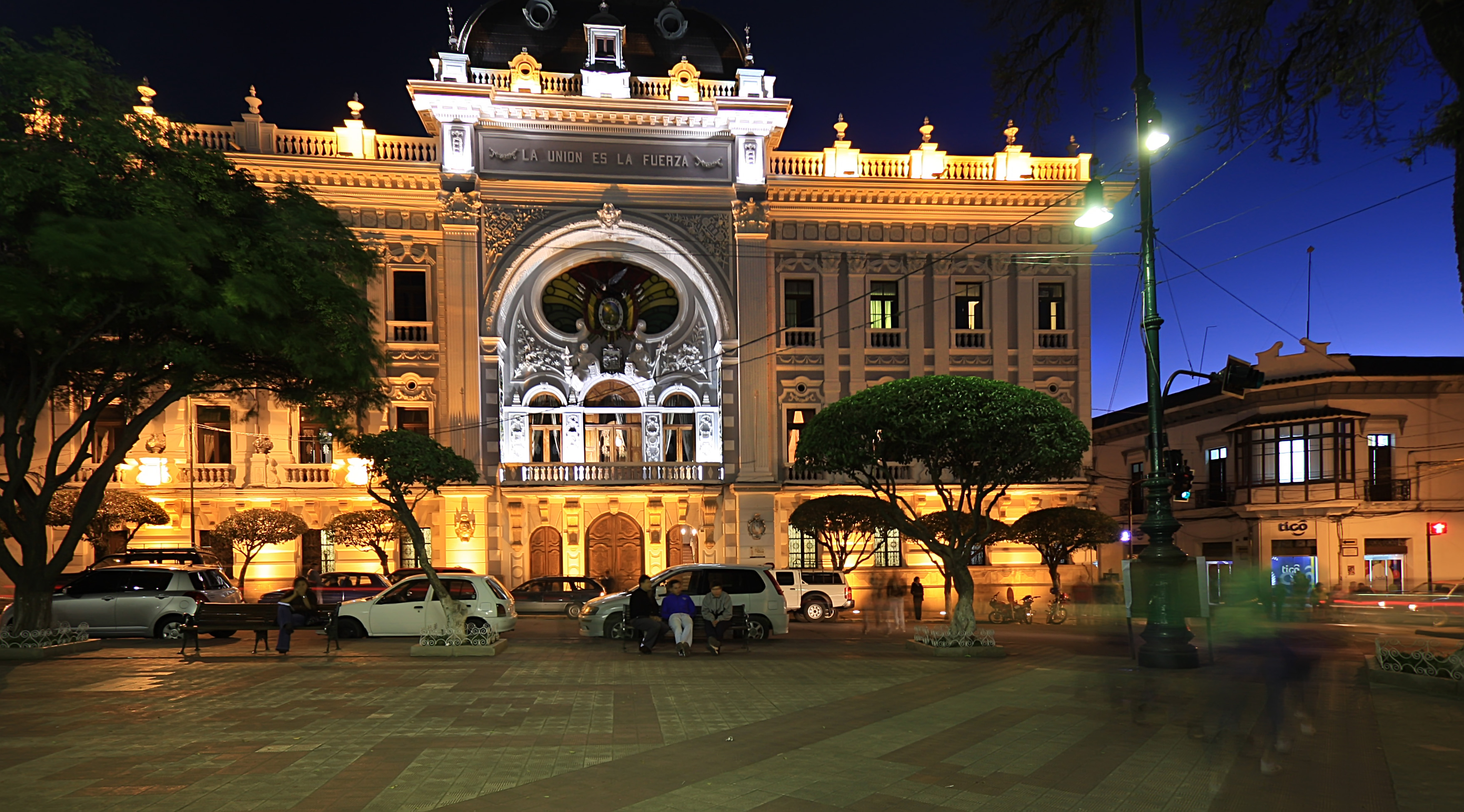
La Paz, Bolivia

La Paz Auditorium

Old La Paz
Abandoned “world’s most dangerous road”


Curious llamas

High up in Cordillera Real

Toll booth in Cordillera Real
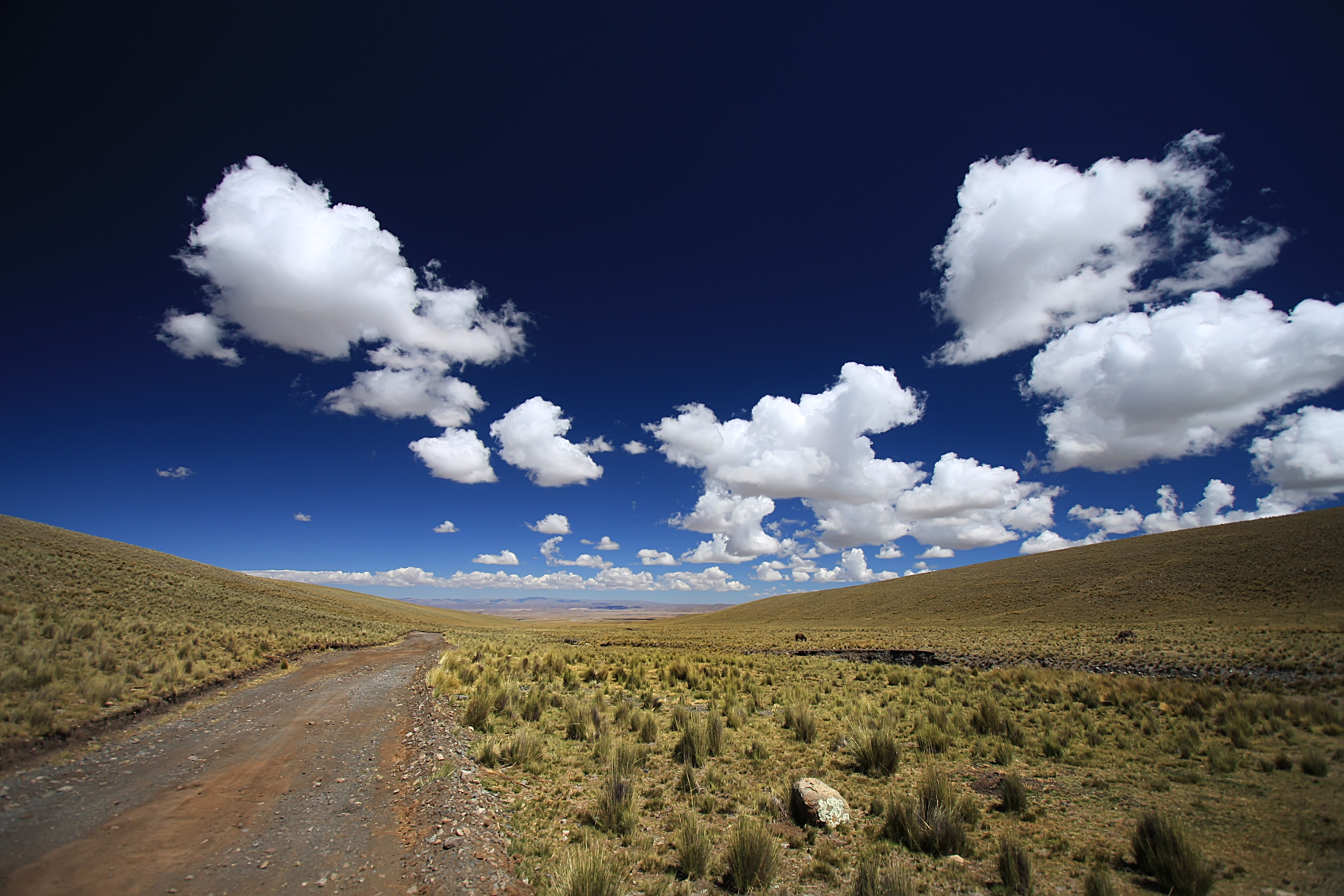
Endless sky of the Bolivian Altiplano

Road climbing up into the mountains


After a cold, cold night in tent

A beautiful vista point

Bolivian Cordillera Real

Playing around

Glacier covered 6000+ m peaks

Late afternoon in the Cordillera Real

On the way to Sorata
I spent next two days relaxing in relative comfort of a German-run hotel and enjoying warm weather. It’s little wonder Sorata is famous among travelers. It sits low enough to be warm, but high enough not to be too hot. Towering 6000+ glacier-covered peaks can be seen from anywhere in the town. I spent half a day with a French-Canadian family checking out beautiful house and land they bought for 18,000 USD. It was sitting on a hill just outside the village with breathtaking views of mighty Andean peaks.

Idyllic Sorata on the eastern slopes of Andes

Parrots in a guesthouse

Deep blue sky of the Altiplano

Watch out for those llamas
Next day, I headed back to La Paz one last time. I didn’t even bother stopping in the city. Instead, I continued straight south to Cochabamba. As the road descended, arid scenery of the Altiplano changed to subtropical and it got pleasantly warm. Cochabamba was anything but typical Bolivian town. There were modern high-rises, fancy shops and restaurants and wide boulevards.
Next day I dropped further down into the tropical part of Bolivia. Santa Cruz was clearly a wealthy city. It even had a Kawasaki dealer. On the streets I could see many Germans who were probably second or third generation Bolivians. I enjoyed German influence by gorging on great chocolate and visiting various bakeries. Next day, I continued towards Sucre – official capital of Bolivia. The first half of the trip was on paved roads, through very pleasant sub-tropical climate. I took my time and ended up riding dirt section in the dark. It was not fun, but I eventually made it to Sucre late at night.
Sucre is another beautiful Bolivian city sitting high up on the plateau. Most buildings are painted dazzling white. The main plaza was a great place to enjoy snacks and watch people. After two nights in Sucre and more great Bolivian chocolate, I moved on to Potosi. I couldn’t help feeling depressed in this city. It was situated so high up that during day, the sun was scorching and it was too cold in shade. At night, it was bitter cold everywhere. So I couldn’t wait to get out of Potosi. In Bolivia too, many roads are being paved – Potosi to Uyuni being one of them.

Sucre’s old buildings are white painted

Sucre

The main square
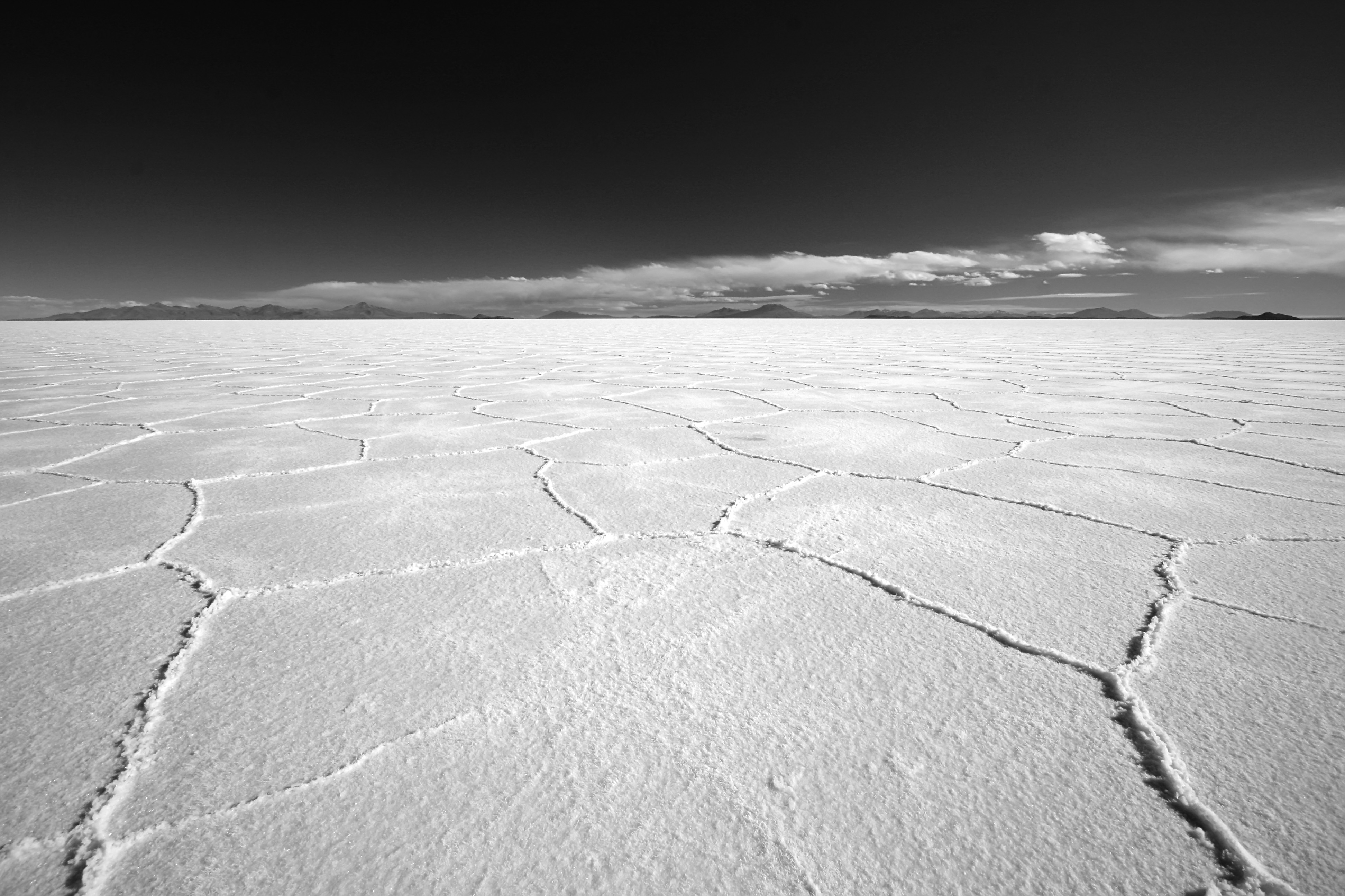
Uyuni was one of the big items on my list of places to visit. Salar flats of Uyuni are world-famous and for a good reason. Besides the surreal appearance, perfectly flat surface allows one to go in any direction for miles and miles. This gives word freedom a whole new dimension. I kept on riding in random directions for several hours and still never got anywhere close to the edge of the flats. This place is huge. In the afternoon, I went to one of the islands. As this used to be a sea, there are traces of corals on the island. Bizarre cacti make scenery even more interesting. I was supposed to ride the flats with Jason, another rider from LA, but he didn’t make it to Uyuni as we planned. On the way out of the flats, I ran into him. So we decided to head back to the island and camp there. Sunset at the flats was probably the single most beautiful experience of the whole trip. The warm colors of the setting sun, the long shadows and the feeling of remoteness and solitude were unforgettable. We enjoyed those magical moments taking pictures and riding bikes around. We were afraid of camping in the flats, but it didn’t get nearly as cold as we had feared. Next morning, we went back to Uyuni and Jason continued north towards LA and I went south towards Argentina.

Me and my twin brother that I never had

One of the few islands in the Salar de Uyuni

The only vegetation are these cacti

No roads, no obstacles, no speed limit

Salar de Uyuni

Two KLRs so happy on the Salar

Late afternoon

Unforgettable sunset on the Salar

Train graveyard outside Uyuni

Salar camping with Jason, a fellow rider from LA
I entered Argentina on a beautiful afternoon and continued south towards Salta on perfectly paved roads. After several weeks of bumping along Bolivian dirt roads, I developed whole new appreciation for paved roads. Excellent and cheap wine was another bonus of being in Argentina. I got to Salta in drizzle, settled in a hostel recommended by Jason and went out to have some Argentinian steak. It’s simply amazing how any piece of beef one buys there is tender and juicy. Even though it was rather cold, I enjoyed my time in Salta.

Beautiful paved road across the border in Argentina

Salta’s cathedral

Border between Argentina and Chile, high up in the Andes
Next day I went to explore surrounding areas south of Salta. After an hour or riding, I decided to turn back and head north and into Chile. This wasn’t very wise and the late start put me at the top of the Andes at Sunset. To make things worse, my motorcycle started stalling at the very crest of the range, between border posts. I was not amused contemplating having to camp in the freezing temperatures. When the motorcycle completely died on me, I tried to look at the problem – in the dark! I drained carb but it didn’t help. Then somehow, I noticed that I had been riding with choke on the whole day. No wonder bike couldn’t handle lack of oxygen so high up. After disengaging the choke, bike fired up and soon, I was descending towards San Pedro de Atacama. That place was expensive and not nearly as attractive as people raved about it. So after a good night rest, I continued south through the Atacama desert.

San Pedro de Atacama

The well-known hand greeting travelers through Atacama

Vast Atacama desert

Cold but dry in Atacama

Off-roading in Atacama

My chain problems continued and in some of the worst places possible. My chain simply broke and got chewed by sprockets in the middle of the desert. Just as I got off the bike to assess the problem, a car stopped and asked me if everything was ok. It was a pickup of the electricity company with three workers going back home for the weekend. After seeing that my chain was destroyed, they simply pushed their stuff away and put my bike at the back of the truck. While riding back to their town, some 200 km further south, they called local motorcycle shop and made sure they had chain in stock. They fed me and showed me some interesting places along the way down. Fifteen minutes after arrival into La Serena, I had a new chain put on the bike. It is amazing how a major technical problem in the middle of nowhere turned into a great experience with friendly Chileans.
As it was getting late into the season, the further south I went, the colder it got. Riding along the Chilean coast was beautiful, but it could have been more so had it been sunny and warm. I finally made it to Vina del Mar and Valparaiso. I decided to stay at Valparaiso, in a beautiful hostel half way up a steep hill. Getting bike there was a challenge, but the views, ambiance and location were well worth the effort. Next day I took bike back to Vina del Mar and that’s where another mechanical problem struck again. I couldn’t start the bike. I tried fixing the problem myself, took the carb off, cleaned it and made sure everything was ok on it. It still wouldn’t start. A friend in the US helped me find a local mechanic who was willing to come to the bike. He quickly found out what the problem was – punctured vacuum hose into carb. He checked other things on the bike and we spent a pleasant afternoon chatting.

My comfy hostel in Valparaiso

Arts everywhere in Valparaiso

Steep hills and funiculars of Valparaiso

Visiting friends in Santiago

Endless switchbacks climbing to cross Andes near Aconcagua
Next day, I went further south along the coast enjoying beautiful sunny day. Eventually, I headed inland towards Santiago de Chile. I arrived late in the afternoon and found a place to stay. Next day I met up with Micha who finally gave up on his idea of reaching Patagonia and was enjoying his time in Chile instead. We went for a ride into Andes outside Santiago the next day. After that, I felt it was time for me to go to Argentina. I slept at the foothills in Los Andes. This enabled me to start climbing the steep incline early next morning. I didn’t want to be at the top of the Andes at night again. Once in Argentina, I took my time riding down towards Mendoza. As a storm was brewing and it was rather cold, I was glad to have quickly found hostel recommended by Jason. There I ran into another rider whom I had met earlier in Chile – a small world. I spent several days there, enjoying wine and beef. Too bad that it was already winter and I couldn’t enjoy the many outdoor cafes and restaurants that Mendoza had to offer.
After a long ride (actually the longest day of my trip – 800 km) I arrived into Rosario after dark. While filling up at a gas station, a lady offered to take us to a new hostel. It was spotlessly clean and we were the only guests there. The only drawback was that we had to park out bikes in a garage and it was not cheap. I spent one day walking around Rosario – the hometown of Cheguevara. It is a popular summer destination for people from Buenos Aires. But in winter, it is pretty quiet.
Next day I made the short ride to Buenos Aires to my friend’s place. We used to work together but he decided that corporate life in the US was not the way to spend his life. So he went to Argentina and never looked back. I spent several days going around this beautiful city, enjoying food, wine and sites. He showed me many places I didn’t know about and introduced me to his friends. As beautiful and enjoyable Buenos Aires was, the calling of open roads was irresistible. So I jumped on a ferry to Uruguay one cold June morning. Colonia, the town on the Uruguay side is a popular tourist destination in summer. In winter, there isn’t much to see or do there. So I continued north to Montevideo. I didn’t know much about Uruguay other than the people were super friendly. Unfortunately, the beef wasn’t nearly as good as in Argentina and the wine was more expensive. After visiting Punta del Este and one more beach town near Brazilian border, I was ready for Brazil.

Glad to be back to Argentina

Celebrating end of the 800 km day in Rosarito

Rosarito

Artsy side of Buenos Aires

My roommates in Buenos Aires

Buenos Aires

Parliament or something similar

French-influenced architecture of Buenos Aires

More of the same

I never knew that southern Brazil could be so cold in winter. It was rather boring ride north to Porto Alegre. Scenery got a bit more interesting there and I visited some canyons and beach towns. Beaches were beautiful but deserted. I visited some areas populated by German immigrants. Whole towns looked like transplanted from Bavaria – with shops, restaurants, bakeries and people. I spent one week in Porto Alegre at my friend’s sister’s place. They took me to various restaurants, told me about their lives in Brazil and introduced me to their friends. Despite rather cold weather, I fell in love with Brazil and Brazilians.

Colonia, Uruguay

Montevideo, Uruguay

Glitzy Punta del Este

And another hand in the sand

My friendly hosts in Porto Allegre
After Porto Alegre, it was a long ride to Iguazu Falls. For the best views, I had to go back to Argentina for the third time. I suffered a rainy day on the way there, but it was followed by a beautiful sunny day, perfect for visiting the falls.

Iguazu falls straddling border between Brazil and Argentina

The devil’s throat
The ride back to the coast was not particularly interesting. It took me a whole day to get to Curitiba. Luckily, the weather got nicer and I enjoyed visiting nearby Paranagua and the famous train ride.
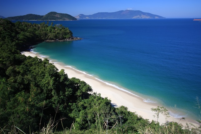
After a relatively short ride north, I ended up in Santos – famous seaside resort for residents of Sao Paulo. I actually slept in a hostel in quieter neighboring Guaruja. I had great time there and I wish I had stayed longer. But the call of Rio was irresistible. Next few hundred kilometers were among the most beautiful sections I rode on this trip. Highway BR-101 is squeezed between rugged coastline and granite mountains covered with lush rainforest. There are countless scenic bays and many islands off the coast. I managed to visit two of them – Ilha Bela and Ilha Grande. Both of them were very pleasant and virtually deserted.

Curitiba

On the way to Ilha Bella

Beautiful road from Paranagua towards Santos

Big, empty beaches between Santos and Rio

Parati

More deserted beaches

On the boat to Ilha Grande
BR-101 is one of the most scenic roads I’ve ridden anywhere

Copacabana
Rio is a very special city. In my opinion one of the three most beautiful cities in the world. Surrounded by beautiful beaches, punctured by granite peaks and hugged by untouched jungle, with conveniences and excitement of a metropolis, this city has it all. The security situation had improved greatly over the years. I felt pretty safe roaming around the city, beaches and even venturing into some shady areas of the downtown. I had spent a week exploring this great city and I only scratched the surface. I was very sad when I rode across the bridge to Niteroi and out of Rio.

Ipanema beach

Fighting for my space next to Jesus high above Rio

Beautiful Rio De Janeiro

The Redemptor

Ipanema

Theater

RIo at sunset

Going for a ride south of Rio

Clear beaches south of Rio
After half a day of riding, I arrived into Arraial do Cabo – white sand heaven on Earth. The town itself is very quaint with a small port and not much going on. It is probably more lively in summer, but this time of the year, it was a perfect spot to relax after an action-packed week in Rio. Nearby Cabo Frio had the most dazzling sand beach I’ve seen in years. Cabo Frio was clearly touristy place with restaurants, hotels and other amenities.

More beaches

Arraial do Cabo
From Arraial do Cabo, I made a day ride to Buzios – party capital of this part of Brazil. Not being a party animal, I barely spent one hour there before running away from all the touristy stuff.
Next day I took a road inland, towards Teresopolis and some spectacular granite domes. Unfortunately, there was a storm brewing over Rio (which is less than 100 south of Teresopolis) and I decided to go further north. After a night spent in my tent by the side of a road, I arrived into old mining town of Ouro Preto. I spent the rest of the day exploring cobble stone streets, shops and cafes of Ouro Preto. Next on the list of historic towns was Diamantina. I passed through a nice national park on the way there and visited a famous waterfall, which was rather dry this time of the year. Still, the ride through Minais Gerais was quite enjoyable.

Ouro Preto

Ouro Preto

Main plaza of Ouro Preto

View from my hotel in Ouro Preto

Ouro Preto

Ouro Preto

Outside Diamantina

Diamantina

Main plaza in Diamantina

Diamantina

Diamantina
After exploring Brazil’s colonial past, it was time to head towards the coast again. I was looking forward to riding through Bahia – the state with most pronounced African influence in Brazil. After visiting a few beach-side towns, I made it to Salvador. It has a reputation for the highest crime rate in Brazil. Warning in the guidebook was very explicit – if you are to be mugged in Brazil, it will be in Salvador. As my luck would have it, it rained on and off whole day I was on the approach to the city and even when I got there. I arrived on a ferry crossing the huge bay where Salvador is situated. From the port, I had to get to the opposite side of the city and navigating the hilly crime capital of Brazil wasn’t easy. Two times I made wrong turns and got a whiff of what ghettos look like. I didn’t wait to experience more of those hoods and quickly turned back to where I came from. Eventually I found a hostel run by friends of a friend and spent several nights there. I really enjoyed my stay in Salvador. If one stays aware of his surrounding, does not walk drunk late at night and use common sense, it is actually quite a safe place.

On the way to Bahia

Salvador

Old town

Touristy part of Salvador

Lady in traditional costume

Happy to be in Salvador

Cobble stone streets of old town

I stayed in neighborhood Barra of Salvador

Colorful houses of the old town

I really wanted to continue further up the east coast to Recife, Natal, Fortaleza and further on towards Belem, but this time of year was the rainy season there. Besides there were some interesting mountains west of Salvador that I wanted to visit.
I spent two days exploring Chapada Diamantina and nearby national parks. Poco Azul was certainly one of the highlights of my visit to Brazil.

Levitating in Poco Azul

Chapada Diamantina
Next big item to check off was riding trans-amazon highway. I timed my whole trip so that I would be there during the dry season. I got more than I bargained for. The dirt was pulverized by all the trucks and buses into very fine powder. Passing a truck or bus was particularly dangerous and only possible near the crest of the hill where they would lose speed and I could not see if there was any on-coming traffic. So half-way through the trans-amazonica, I decided to bail out. I went to Santarem where I recuperated for a few days at Altar do Chao – white sand beach heaven on Amazon.

White sand beaches of Altar do Chao
A two-day boat ride got me and my bike to Manaus. I was the only guest at the hostel there and was treated with special kindness by the owner. I just wish I could speak more Portuguese. I made a side trip north to the Equator through old-growth rainforest. I saw several big snakes and rode over one of them.

Downtown Manaus

Who is the odd passenger sleeping in a tent?

A fellow passenger on the boat

Equator is only a short ride north of Manaus

The famous Manaus opera house

My extra friendly hosts at HI Manaus
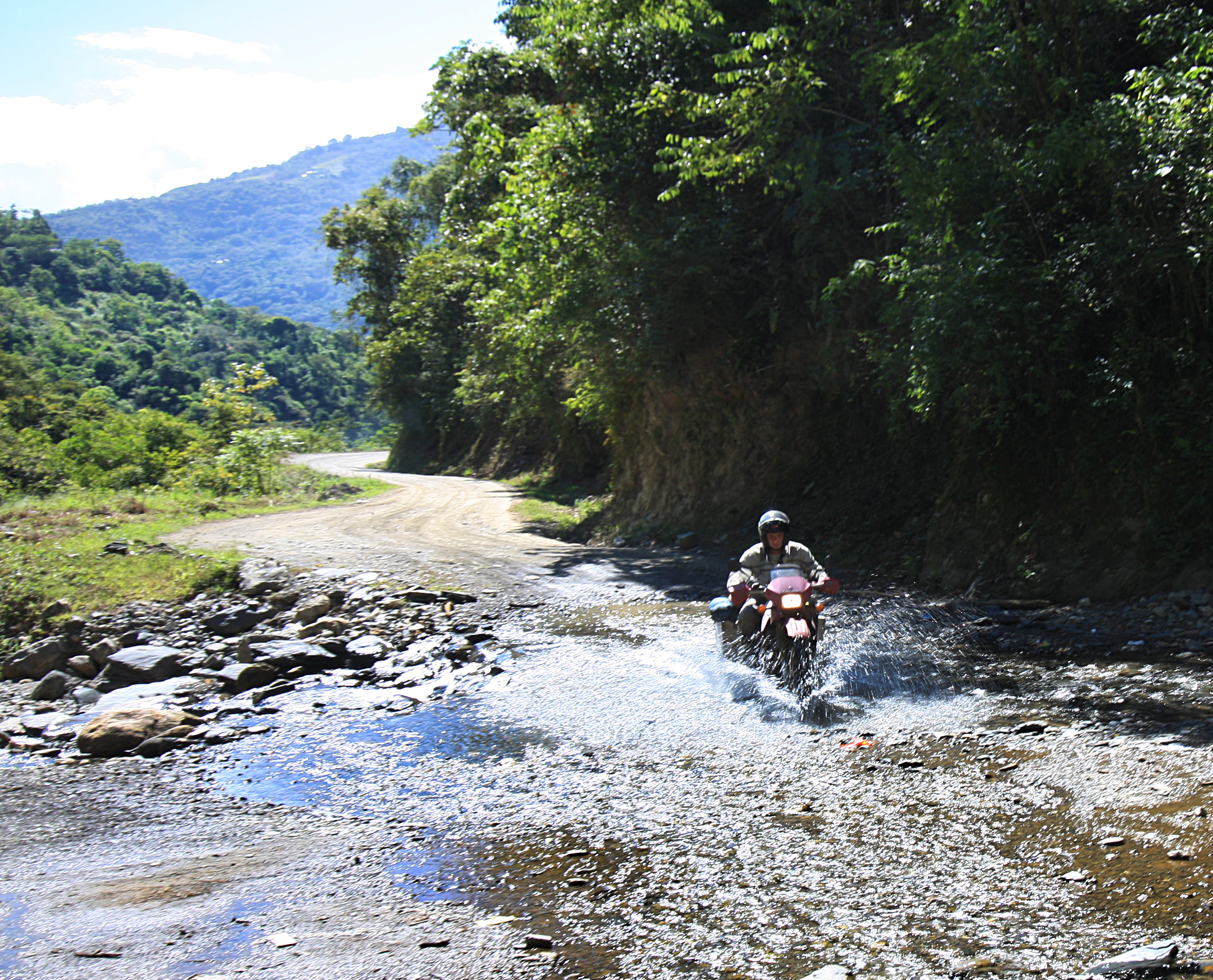
I was happy in Manaus and wanted to stay longer, but it was time to move on and ride the dreaded BR-319 to Humaita. I read some scary trip reports about this route. I got 30 liters of extra fuel, 8 liters of water and even a machete to fight panthers that inhabit this area. The road wasn’t nearly as bad as I had expected. While I managed to lose most of my water, the fuel I brought was more than enough for the trip. So after two nights of sleeping by the antenna towers (they are fenced off and supposedly panthers cannot get in), I arrived into Humaita.

Motorcycle ferry

Poorly maintained bridges are the biggest obstacle on BR-319

After three days of BR-319, finally in Humaita
This was the last big item on my “to-do” list and beginning of the end of my trip. I booked a flight back to LA from Lima and had to get back to Peru. The ride back was not particularly interesting and took me through western Brazil into Peru, back to Cuzco, Nasca and eventually Lima. I did want to visit Huaraz and admire mighty Cordillera Blanca one more time. The window for climbing has already closed and most peaks were obscured by clouds again.

Crossing Andes from the east

Beautiful Andean vista

Cuzco girl

Cuzco

Ran into a fellow rider Vince in Cuzco

Approaching Nasca after a long ride from Cuzco
In Caraz, I found a buyer for my bike. It just didn’t make sense to pay over $1500 to ship that beat up bike back to the US. As a celebration, I booked a flight to Iquitos, the center of the Peruvian slice of the Amazon. There, I stayed at a jungle lodge, went piranha fishing and jungle tracking.

LIma’s fountain park

Switchbacks leading to the pass on highway 20 out of Lima

Kuelap ruins

New proud owner of my KLR
All things must come to an end and so does my motorcycle tour of the Latin world. It’s been an extremely fulfilling and rewarding journey, almost a life-changing event. I will never forget the ancient ruins of Mayas and Incas, beautiful Andes, great beaches of both Pacific and Atlantic, endless skies of the Altiplano and, above all, the warm, friendly, welcoming and helpful people. I’ll be dreaming of this place while planning my next trip to the South America.

Panniers with stickers brought back to remind me of the good times I had in South America